GPS + Barometer Fusion
Satellite altitude for accuracy, air pressure for instant response. One readout you can trust on a ridge line.
The altimeter that works where the internet doesn't
No cell service. No Wi-Fi. No problem.
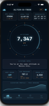
GPS gives you absolute altitude. The barometer gives you instant response. Altim-O-Tron fuses both into one smooth, honest readout — satellites for the truth, air pressure for the reflexes.
The result updates the moment you step up a ledge, but is still accurate when you're back at sea level is an hour later. Every calculation happens on the phone in your hand, using sensors that were already there.
GPS satellites don't care if you're off the grid.
Everything below runs on sensors your iPhone already has, with no account, no signal, no log-ins and no subscription.
Satellite altitude for accuracy, air pressure for instant response. One readout you can trust on a ridge line.
300+ landmarks, animals, and disasters that mark every elevation. You are currently level with something. We'll tell you what.
Feet and meters, obviously. Also fathoms, furlongs, smoots, and giraffes. Choose wisely.
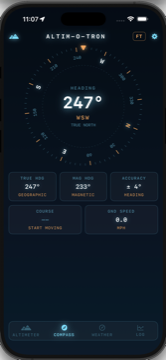
A proper rose with true north computed on-device, plus course and ground speed in units of questionable judgement.
Captures your elevation profile with the screen locked and the phone in your pocket. Export any session as GPX.
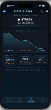
An offline barograph logging sea-level-corrected pressure and its three-hour tendency — the oldest forecast there is.
A database of 300+ things at every altitude, from the wreck of the Titanic to the boundary of the stratosphere. All presented as you climb.
You're at the same altitude as
Mexico City
300+ entries · entirely offline · no lookups
Six ways to express exactly how far above the sea you are. Two of them are sensible.
Displays altitude in giraffes.
For science.
Magnetic north is where the needle points. True north is where the map thinks you're going. Altim-O-Tron computes the declination between them on-device and shows you both, alongside your course and ground speed.
Yes, speed can be displayed in furlongs per fortnight.
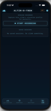
Start a session at the trailhead and then put the phone away. Altim-O-Tron keeps recording your elevation profile with the screen locked, then hands you total ascent, total descent, and the whole shape of the day when you're finished.
Export any session as a standard GPX track — geotagged and ready for the Geotag-O-Tron, the GPX-O-Tron or any of those other GPX mapping tools.
Works beautifully in airplane mode.
Mostly because airplanes are high.
The barograph logs air pressure for 48 hours and corrects it to sea level using your altitude — so climbing a hill doesn't read as an incoming storm.
Then it reads the three-hour tendency: steady, rising, or falling. Falling fast is the sky's way of suggesting you head down.
Sailors relied on this for centuries.
Of course they only had mechanical chronographs or flip phones.
No networking code.
We literally can't spy on you.
For iPhone, running iOS 17 or later. Every iPhone that can run it has the barometer built in.